August 11, 2023
We’ve changed how we process and create the demographic counts for this update and all future updates. It’s a relatively small change, but clients using older versions of the Postcode boundaries will get slightly less accurate demographic counts.
This only impacts a minimal number of records, expressly where the Postcode provided by the supplier of the data does not match what we have in Vision. Previously, in those instances, we would transfer “our” Postcode Sector within which the location was situated. We used to do this for each of the different historical versions of the Postcode Sectors, covering the 2015, 2020, 2021 and 2022 versions.
From this update and for all future updates, we will only transfer the latest version of Postcode Sectors to these records. This means if these fall within new Postcode Sectors, they will not be included in the demographic counts for any historical Postcode Sector versions that did not include them. Also, the demographic count might be slightly inaccurate on rare occasions with slight boundary changes.
See the below images as an example.
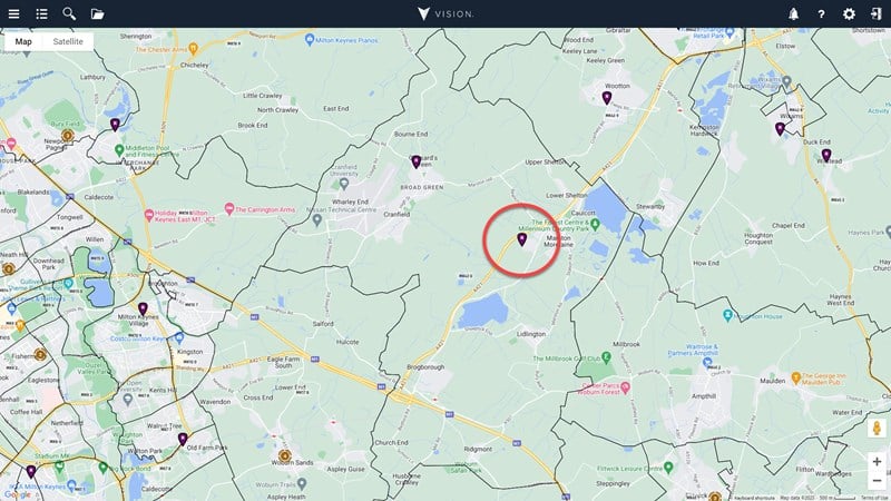
2015 Postcode Sectors
2022 Postcode Sectors
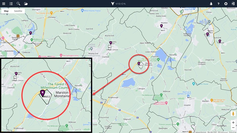
The first image shows the 2015 Postcode Sectors, and the second image shows the 2022 Postcode Sectors. You’ll notice that the highlighted Residential home is now located within a new Postcode Sector, MK43 2. This means it will no longer be included in the demographic counts for the 2015 Postcode Sectors.
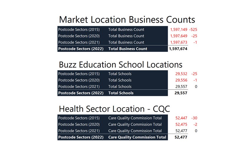
Please see the table below for the difference in numbers for the upcoming update. As you can see, they are minor, but we would recommend updating to the latest version of the Postcode geographies to uphold as much accuracy as possible.
Why are we making this change?
The need for us to change how we process these data updates has become more and more pertinent with each new release of the Postcode versions. The time taken to process each dataset for all of the geographies available within Vision, so not just the Postcode geographies and their different versions, but the Administrative hierarchy as well, was becoming too great. Especially when, regardless of how we process the data, if our clients are not referencing the latest versions of the geographies, then those demographics have limited accuracy anyway.
Is there any help available with updating to the latest boundaries?
Yes, we’ve got a help centre article and a video to guide you through the process.
Article - Updating to the latest boundary release.
Video – How to update to the 2021 Census in Vision.
The video is part of our “How to update to the 2021 Census in Vision” video. The first four and a half minutes provide step-by-step instructions on performing the update and managing the Postcode changes in Vision.
Furthermore, we’re always on hand to help if you get stuck or would like any questions answered before, during or after the update. Please feel free to contact us for any additional support.