September 3, 2019
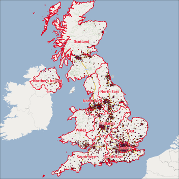
In this blog, we take a look at the locations of shopping centres in some selected cities of interest. We use some simple visualisations such as drive times, thematic shading and then look at the demographic data to see just what kind of opportunity a city contains.
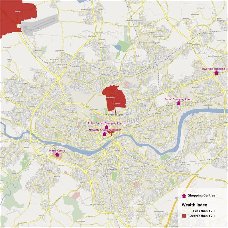
Newcastle
- Population – 611,117
- Households – 277,395
- Wealth – 78.64
- Businesses – 16,563
- Shopping Centres – 5 Approximately
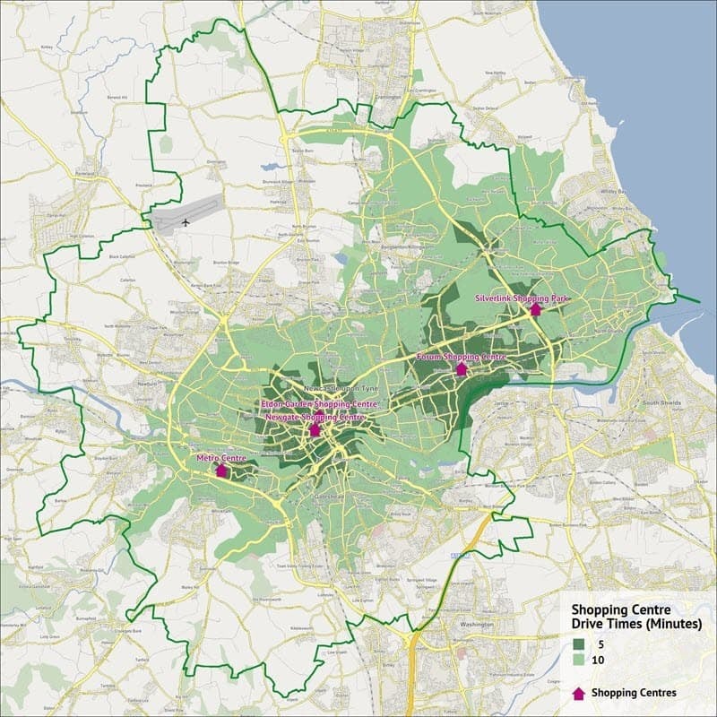
As we can see in the image the majority of the city can reach a shopping centre of some form within a 10 minute drive time. The shopping centres are all easily accessible, and can normally be found near main roads providing easy transport links throughout the city.
Newcastle as it goes, is one of the larger cities in the UK, with a high number of population, households and businesses, in comparison to the other cities selected for this blog. What is interesting is the difference in wealth, with Newcastle’s disposable income per household being more than 20% lower than the national average. It is known that the south of the UK contains the vast majority of the wealth, typically the closer to London you are, this statistic goes a long way in agreeing with it.
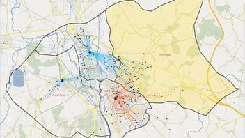
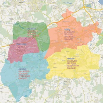
The final image shows the particular hotspots of wealth that can be found in Newcastle and as we can see, these are located in and to the north of the city centre, with some more as we move out of the city.
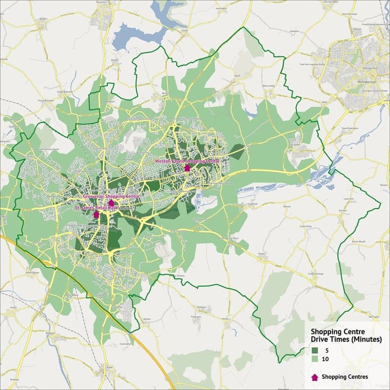
Northampton
- Population – 233,332
- Households – 100,534
- Wealth – 95.24
- Businesses – 7,265
- Shopping Centres – 3 Approximately
The drive times in Northampton show that all parts of the city can reach a shopping centre comfortably within a 10 minute drive time. Again the shopping centres are located near major roads and are all located north of the river.
In terms of its size, it’s a fairly mid ranged city with substantially less opportunity than that of cities such as Newcastle. However, as we can see, we’ve moved out of the north and the wealth of the city is substantially higher that of Newcastle and is starting to reach towards the national average.
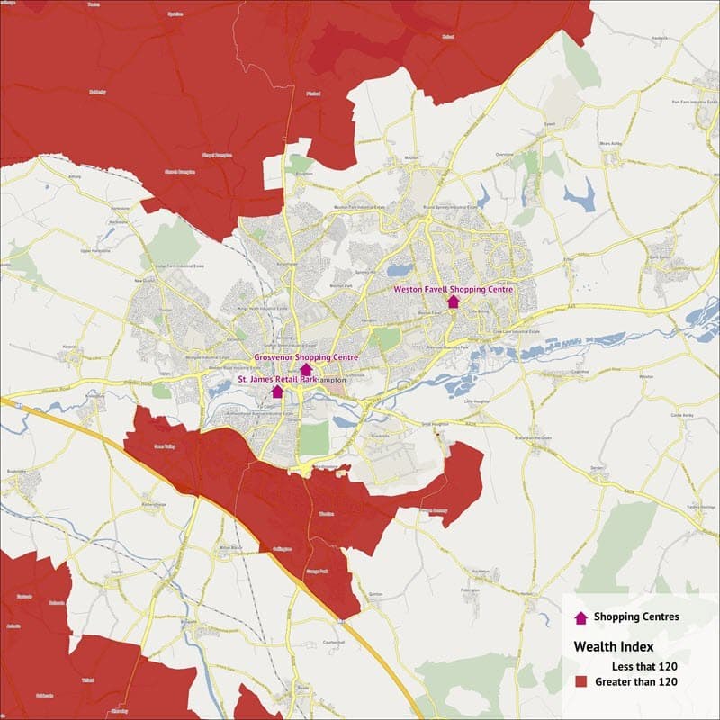
If we look at just where those wealthy areas are we can see that they are located away from the city centre, to the north and south of the city. In the main this is where you can find larger properties with more land, people from these areas will either travel into the city centre for work or are in a better location to commute to other cities for their higher paid jobs. The hotspots of wealth in the south are located right next the M1 motorway providing better access to large cities such as Birmingham or London and any in between.
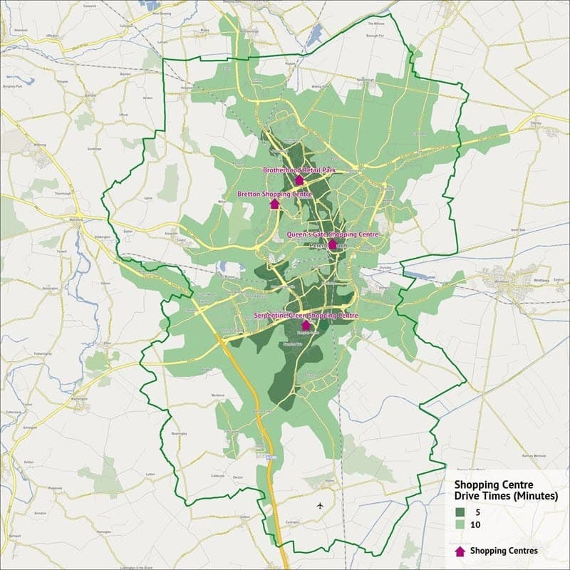
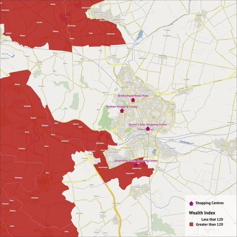
Peterborough
- Population – 188,561
- Households – 78,764
- Wealth – 98.43
- Businesses – 5,644
- Shopping Centres – 4 Approximately
Again we can see that people can travel to a shopping centre within a 10 minute drive time throughout Peterborough. The shopping centres are also centrally located and follow the main transport line of the roads and railway running from north to south through the city. This allows the population to easily access the shopping centres, whilst also making logistical sense for the shopping centres.
Peterborough is the smallest of the 3 cities in terms of demographic size but has the highest level of wealth. As we can see the wealthy areas again are located as we move away from the city centre, in the south-east and to the north of the city.
With just some really simple statistics and visualisations we can gain a far better insight into these areas, if there are any areas of the country or topics that are of particular interest to you, please feel free to drop us an email and we will consider focussing on these in our next blog.