February 17, 2026
If you are planning new locations, reshaping territories or trying to get more from your existing network, you will bump into the phrase catchment area calculation fairly quickly. It sounds technical, but at its heart it is simply about answering one question:
“Where do our customers actually come from and how far could we realistically reach?”
In this guide we will walk through what a catchment area is, the main ways to calculate it, how a modern catchment area tool or finder should work, and a simple template you can adapt for your own business. We will also show how Atlas Mapping and our Vision software fit into the picture.
What is a catchment area?
A catchment area is the geographic area from which a location draws its customers, users or service recipients. On a map it is usually shown as a shaded region around a site, often based on things like travel time, travel distance or local boundaries .Retailers, franchises, healthcare providers, local authorities and education providers all use catchment areas to understand who they serve and where there is potential for growth or gaps in coverage.
For businesses, catchment areas are the starting point for:
- Site selection for new branches, clinics, shops or depots
- Territory mapping for franchises and field teams
- Local marketing and campaign planning
- Capacity planning, staffing and logistics
- Avoiding overlap and cannibalisation between locations.
If the catchment area is wrong, every decision that rests on it is on shaky ground.
Three main approaches to catchment area calculation
There is no single formula for catchment area calculation. Instead, you choose a method that fits how people travel to your sites and how your business operates. The most common methods, used across many mapping and analytics tools, are these.
1. Simple distance or buffer catchments
This is the classic approach. You put a circle around your location at a chosen distance, for example 5 miles around a gym or 2 miles around a convenience store.
This type of catchment is sometimes called a buffer trade area. It is quick and can be useful for a first pass, especially when you want to compare your footprint against competitors.
The drawback is that it ignores real world travel patterns. Ten miles in rural Scotland is very different from ten miles around the M25 at rush hour.
2. Walk and drive time catchments
A more realistic approach is to build catchments based on travel time rather than straight line distance. For example:
- 10 minute walk for a local café on a high street
- 20 minute drive time for a garden centre
- 45 minute drive time for a destination outlet or leisure attraction
These are called isochrone maps. They take into account the actual road network and transport options, so you see a much truer picture of how long it takes people to reach you.
Walk and drive time catchments are ideal when you are:
- Balancing coverage with service quality
- Comparing the reach of multiple sites
- Looking for gaps in your network where you could add a new location
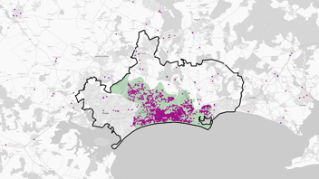
3. Behaviour based or mobility catchments
The most advanced catchment area calculation methods draw on observed behaviour. Instead of assuming that people will travel in neat circles, they look at real patterns of movement and visit behaviour for different types of location.
For example, you can:
- See which postcodes visitors are actually coming from
- Understand how far different customer segments will travel
- Combine mobility, demographic and customer data to see who you are really attracting
This gives you a dynamic catchment that reflects real behaviour rather than tidy geometry.
In practice, most good catchment strategies use a blend of these approaches. At Atlas Mapping we often start with time based isochrones, then refine with behaviour and customer data once we have a baseline.
What a catchment area tool or finder should do
If you are searching for a catchment area calculation tool or catchment area finder, there are a few things worth checking before you commit.
A modern tool should let you:
- Choose your method
Radius, walk time, drive time, administrative boundaries such as local authorities or postcode sectors, or your own custom shapes. - Combine multiple data sources
Your own customer, sales and location data plus third party demographic, population and business data. - Compare many locations at once
See overlap between existing sites and potential new ones, spot gaps, and understand where territories might cannibalise each other. - Share results clearly with stakeholders
Franchisees, operations teams, finance and investors should all be able to view and understand the catchments without specialist GIS skills. - Update easily as your network grows
Your catchment areas will not stay static. You need to be able to refine them as you open new sites, change your offer or see shifts in customer behaviour.
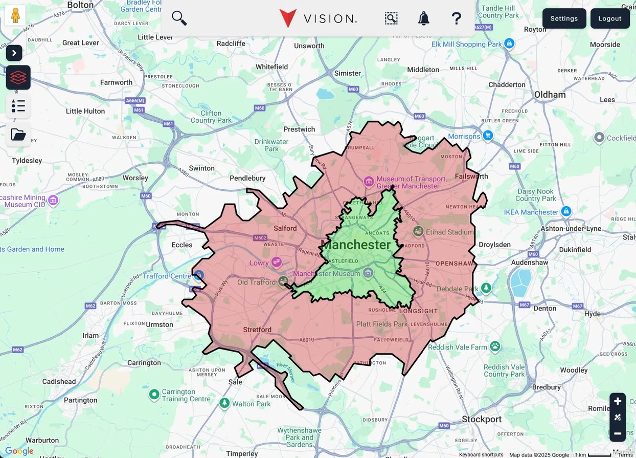
Our own platform, Vision, was designed specifically for businesses and franchises that want this kind of power without complex, technical software. It combines your data with third party information in a simple online tool and supports territory mapping, catchment analysis and network planning in one place.
How Atlas Mapping approaches catchment area calculation
Atlas Mapping has worked with hundreds of brands, many of them franchises, to design territories and catchment strategies that can scale. The short version: we live and breathe this stuff. Our team has created and shared well over one hundred thousand territories, and Vision has become a central planning tool for clients across sectors from care to automotive.
Our typical process brings together:
- Location intelligence - We start from where your current sites and customers are, layer in competitor locations and look closely at the geography that really matters.
- Tailored catchment rules
We help you choose the right catchment area calculation method for your model. For some brands that may be postcode based territories. For others it is drive time catchments or a mix of both. - Data driven sizing
We use relevant demographic and demand drivers for your sector, such as household income, age profile, population density, or specific niche indicators, to size each territory fairly. - Practical, on the ground testing
Our work is not just theoretical. We check that catchment areas and territories feel right to people who know the ground and tweak where needed. - A simple tool your team can actually use
Everything is delivered through Vision so your team can explore maps, run scenarios and keep your catchments and territories up to date.
The result is a catchment strategy that is robust enough for board level decisions but still easy to explain to a franchisee, store manager or investor.
A simple business template for defining catchment areas
If you are just getting started, it helps to work through a basic template. You can adapt the steps below for a single site, a pilot franchise territory or a full national network.
1. Clarify your objective
- What decisions will this catchment support?
- Are you planning a new site, reviewing performance, or redesigning territories?
2. Define your ideal customer
- Who are you trying to attract?
- Which demographics or behaviours matter most?
- Are you serving local, regional or national demand?
3. Decide on your primary method
Pick one main method for your first version of the catchment:
- Radius or buffer (distance based)
- Walk time or drive time (travel time based)
- Postcode sectors, districts or local authority areas (administrative boundaries)
You can refine later with more detail, but try not to overcomplicate the first pass.
4. Choose your key metrics
For each catchment, decide what you will measure. For example:
- Total population within the catchment
- Target households or businesses
- Estimated demand or spend
- Existing customer count and revenue
These scores will help you compare catchments and size territories fairly.
5. Build and visualise in a catchment area tool
Use a catchment area tool like Vision to:
- Add your locations
- Define the catchment rules
- View overlap and white space
- Export maps and statistics for wider discussion
6. Sense check with local knowledge
Share the maps with people close to the ground. Ask:
- Does this reflect where your customers really come from
- Are there obvious barriers or pinch points we have missed
- Does the catchment feel fair compared to neighbouring areas
7. Lock in, then review regularly
Once you are happy, lock in the catchments and use them consistently for planning and reporting. Set a review point, for example annually or when you hit a certain number of locations.
When to bring Atlas Mapping in
You can experiment with catchment area calculation on your own, especially if you have one or two locations. Where Atlas Mapping really adds value is when:
- You are scaling a franchise and need a national territory and catchment strategy
- You are planning a significant roll out of new sites across the UK or internationally
- You have complex service rules, for example overlapping service areas and exclusive territories
- You need a credible, data led framework to present to investors, boards or prospective franchisees
We help you “solve complex problems with logic and grace”, as we like to put it, and show you that mapping and analytics can actually be enjoyable along the way.
If you would like to see how a dedicated catchment area finder and mapping platform could work for your organisation, the best next step is to have a look at the Vision demo and get started for free today or get in touch with the team. From there we can explore your current network, sketch out some catchment options and give you a clear view of where to take your business next.