March 7, 2016
In this month’s blog, we’ve taken a look at historical locations throughout England and Scotland, these are categorised as Registered Battlefields, Protected Wrecks and World Heritage Sites.
- England Protected Wrecks – 49
- England Battlefields – 48
- Scotland Battlefields – 39
- Total Battlefields – 87
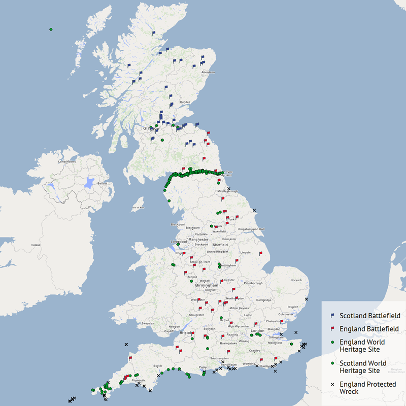
The image above shows the location of each historical landmark throughout the country. How many of these landmarks are you familiar with, if any?
Scotland
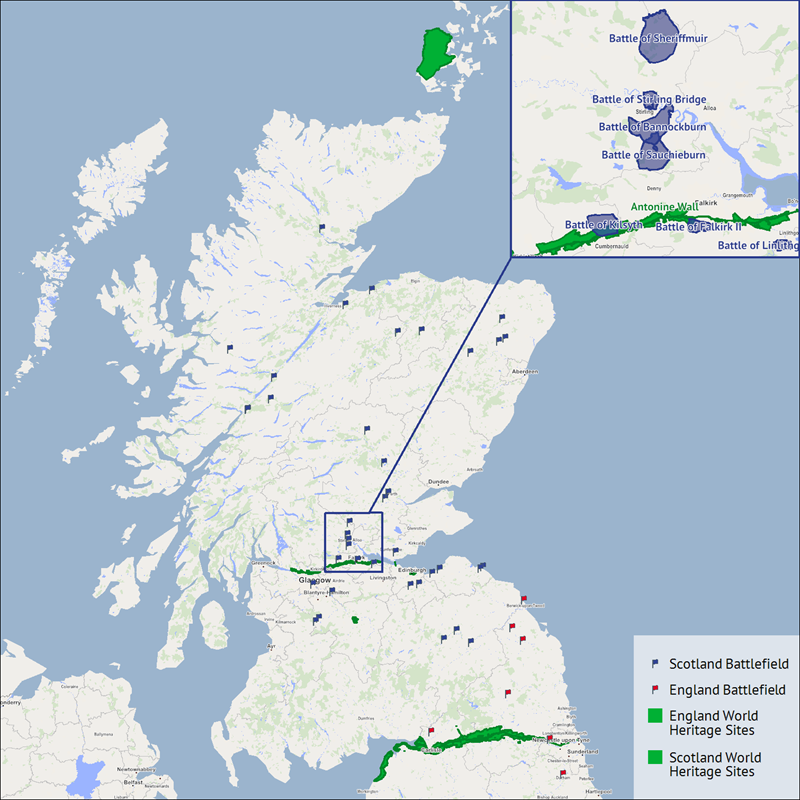
We’ve now taken a closer look at Scotland and you can now see some key locations in more detail. Firstly, the two famous walls. We’ve got Hadrian’s Wall towards the bottom of the image and then there’s the Antonine Wall stretching from Falkirk to the North of Glasgow.
The map in the top right of the image shows the location and size of some of the protected battlefields. We were interested in two of the more famous ones, both of which took place in and around Stirling, and were famously successful and important for Scottish independence. If you want to find out more about them, click on the links below and there’s a wealth of information for each event.
England
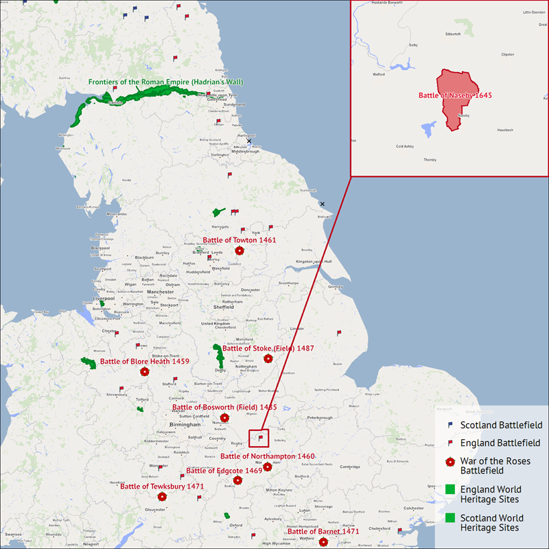
In our closer look at England, the first image shows the historical landmarks in more detail. We’ve also grouped and highlighted the protected battlefields that occurred as part of the Wars of the Roses. These events lasted from 1455 until 1310, the final victory took place at the Battle of Bosworth Field (1485) when Henry Tudor defeated the last Yorkist King, Richard the 3rd. It’s interesting to see the spread of different locations that the conflicts took place.
The map in the top right of the image highlights one of the most significant battles to take place in England, this was the Battle of Naseby (1645). This was the decisive victory of the First English Civil War for Parliament, as a consequence, the Monarch would never again be supreme in British politics. For more information and insight into the battle and its meaning click on the link below.
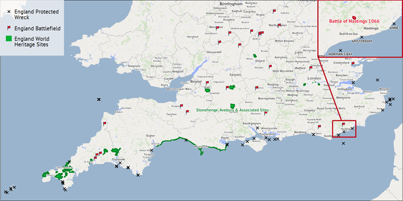
The second image provides a closer look at the South of England, in this image you can see just how many protected wreck sites are situated on the south coast of the country. This clearly reflects where the more predominate ports were and the more dangerous areas of the coast. We’ve also highlighted the location of the World Heritage Site Stonehenge, to the north of Salisbury.
The map in the top right shows the location of the battle of Hastings (1066), one of the more famous and well-known conflicts that took place in England. Again, if you want to find out more, click on the link below.
We hope that you’ve found this blog interesting, if you have any questions or data that you would like to see featured in an upcoming article, please get in touch.


